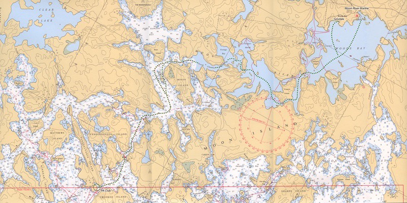
Area Charts
There are six different charts you can download. The first two charts show the water route from Moon River and Grisdale marinas in Woods Bay to the PA Club. Chart 1 is of high quality, suitable for printing. Chart 2 is the same chart, but of lower quality. The other four charts are divided into four quadrants with the Club centered approximately in the middle. For first-time visitors to the club, it's also recommended that you download the written directions via boat from Woods Bay to Pennsylvania Island and also take a look at the video showing the route to the club.
All charts are PDF files. Chart 1 is best printed on some large format paper, at least legal size. The rest are sized for standard letter size paper and it is recommended that they be printed on photo quality paper. You can cut and tape them together or leave the pages separate. They will stay dry if you laminate them or at least keep them in a large ziploc bag.
Chart 1: Woods Bay to the PA Club (large file, 40 MB). Preview
Chart 2: Low quality chart of the route to the club (less than 1 MB).

Here are the coordinates for the Club: N45° 10.75, W80° 05.12.